How to behave and prepare a boat when approaching a storm?
2. August, 2024
We have noticed that global warming is causing extreme heat and sudden and severe weather changes worldwide. Croatia is not spared from global warming and thus not from all these changes either. The impact of these climatic shifts is becoming increasingly evident in various aspects of life.
Rising sea levels threaten infrastructure and ecosystems in coastal areas. The changing weather patterns and rising temperatures significantly impact the frequency of heat waves. Moreover, the increased occurrence of localized dangerous thunderstorms demands our attention. Even modern meteorological forecasts never provide precise data on the location and time of a storm's occurrence, usually indicating it as a localized possibility over a wider area. However, experience has shown that even in this unpredictability, there are some rules and clear signs of an impending storm.
Understanding how to behave and prepare a boat when approaching a storm
Let's inform boaters about storm preparation.
Here are some ways to inform boaters about recognizing and preparing for storms while navigating the Adriatic Sea. By understanding the signs of an impending storm, you can feel more informed and prepared, enhancing your confidence in your ability to navigate safely. Understanding how to behave and prepare a boat when approaching a storm is not just crucial; it's empowering. This knowledge gives you the control to ensure the safety of your vessel and everyone on board, instilling confidence in your abilities and a sense of control in potentially dangerous situations.
Nevera (local storm) in Croatia
A local storm called Nevera in Croatia is not just any bad weather with strong winds and heavy rainfall, but precisely one that shows independence from previous weather conditions in its formation, development, and departure. It is characterized by sudden and severe wind gusts, heavy rainfall, and rapid changes in weather conditions, often leading to dangerous sea conditions. [specific characteristics of Nevera]. Usually, the second half of August and April are known for their erratic weather and are periods when storms occur more frequently. They almost always develop on land, mainly over valleys shielded by mountains from the western air currents, during summer heat waves, high air temperatures, and stillness. It is precisely this sudden and significant change in weather conditions that makes them dangerous. Storms most frequently occur in the afternoons between 12:30 PM and 5 PM but sometimes later or earlier.
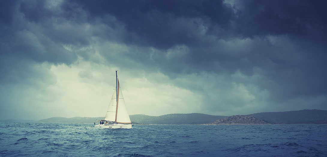
If one appears in the morning, it can also be expected in the afternoon. Storms coming from the west and northwest are more common. Rainfall is preceded by simultaneous lightning and thunder, one to three times, and driven by strong winds; it falls at a sharp angle, almost horizontally. It's difficult to predict whether a storm will bring rain or hail, but in the case of rainy storms, the thunder is more powerful, and if it starts with a heavy downpour, hail is almost sure not to follow. The brief appearance of yellow-brown clouds with ragged edges racing towards the dark centre of the storm suggests hail is imminent. Dark clouds with no visible edges and stretch indefinitely bring a stronger storm than those with clear skies on one or both sides. If you can see the sky, horizon, or other clouds beneath a dark cloud, that cloud does not carry a storm.
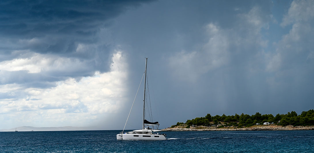
Likewise, regardless of all previous signs, if the wind turns to the left, it's a sign that there will be no storm. Although storms can appear quickly and suddenly, they can often be predicted a day in advance. A clear sunset in the west indicates a storm-free next day. The next day's storm chances are high if high clouds persist, especially over the sea.
These signs provide a sense of reassurance and reduce anxiety about the unpredictability of storms, making you feel more secure and less anxious:
- The wind calms down.
- The air temperature rises.
- It becomes muggy.
- A light breeze briefly blows in the storm's direction.
Completing all preparations for the bad weather on your boat is crucial as the storm approaches. A thick curtain of rain, a darkened sea, and leaden clouds rapidly approaching can cause discomfort, concern, and even fear.
A secure berth in a sheltered marina is ideal for patiently anticipating a storm.
However, with good preparation, you can navigate the storm with confidence and security, knowing you're ready for any situation. A secure berth in a sheltered marina is the best place to await a storm. Stow, tie down or remove anything that the wind can tear or blow away, such as awnings, biminis, and sprayhoods, from the deck and cockpit. Check the positions and fastenings of the fenders, and if necessary, strengthen the windward mooring lines. Ensure that the masts of two adjacent sailboats are not aligned to avoid them hitting each other during rolling and pitching. Secure the Genoa roller to prevent it from accidentally unfurling in solid winds, and tighten the sail packed on the boom well. Close all portholes and hatches, take shelter in the cabin, and wait for the storm to pass. Keep rain gear handy, as there is always a chance you might need to go on deck due to an unexpected situation.
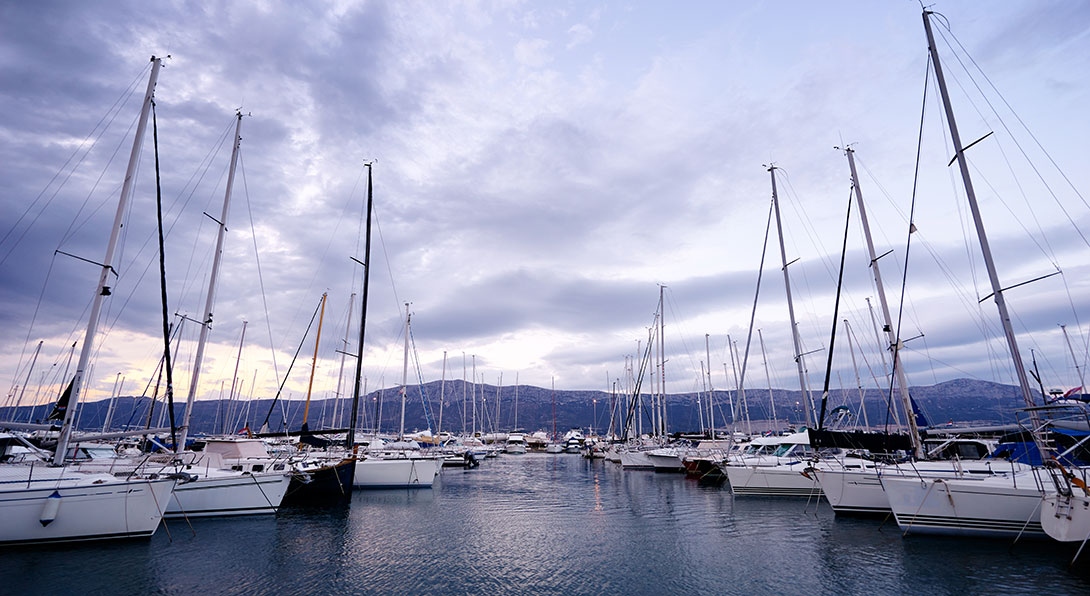
Despite your good preparations, be aware that there are always risk-takers who stubbornly try to enter the Marina during the storm, looking for a free berth. As the Marina is the safest place during a strong storm, this is the most dangerous of all the hazards that can occur in a marina during a storm.
A secure berth in a sheltered marina is ideal for patiently anticipating a storm.
Beware of Dangerous Neighbors, which refers to boats anchored close to your boat in a bay during a storm. Their proximity can pose a significant risk to your vessel, as their anchors may not hold, and their boats may drift into yours, causing damage or a collision. Considering this risk when choosing an anchorage during a storm is essential. If you notice an approaching storm while anchored in a bay, consider whether to stay there or set sail. If there is any doubt about the safety of the anchorage, that is reason enough to lift the anchor, especially from bays open to westerly winds. Being well-anchored in a sheltered bay can provide considerable security, but you must be more comfortable. No matter how confident you are in your anchor, there is always the danger that another boat in the bay will drag its anchor across yours. Additionally, there is the constant danger from those who seek shelter right next to you during the storm. In such conditions, it is difficult for them to hear you, and if they do hear, it's uncertain what they understand. Instead, monitor their reactions and anticipate possible developments.
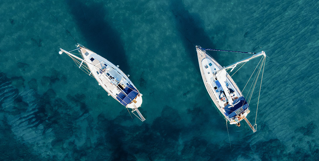
The old fishermen's saying goes: 'In a storm, a friend shouldn't come near.' This saying reflects the understanding that it's every boat for itself in a storm, and attempting to help others can often lead to more problems. Two anchors provide more security than one; don't take the risk if you need clarification on the outcome. In case of an urgent need to leave the berth, this will only complicate an already tense situation.
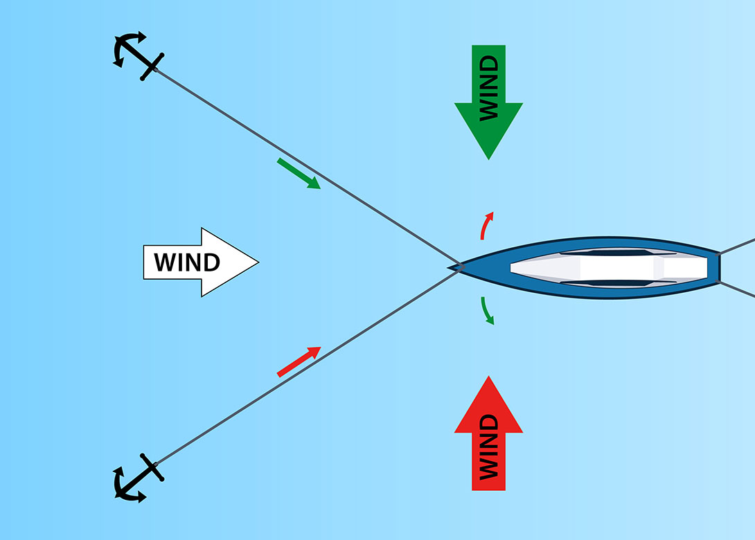
When securing, it's good to place the second anchor further north, as wind from some northern direction can be expected after the storm. The boat should be prepared to quickly and safely set sail at any moment. All mooring lines must be easy to untie and accessible so they can be quickly released and thrown ashore if necessary. In such situations, it is crucial to have a sharp knife. Pull the anchor rope outside the rail, so if complications arise while lifting, you can throw the entire rope into the sea, both anchors, one by one. Do not attach floating markers, fenders, or similar items to the ends, which can get caught on the keel, rudder, or propeller. Anchors with chains instead of ropes usually have the chain end tied to some catch in the chain locker.
Let's help boaters prepare for Adriatic storms
Before the storm arrives, release that end of the chain and let the entire chain into the sea if necessary. You can retrieve the ropes and anchors later when everything has calmed down. In a storm, timely reaction and prompt action can be crucial, so keeping the engine running throughout the storm is advisable. Even if there is no need to sail, you will have charged the boat's batteries. A dinghy or inflatable boat is usually tied to the stern and can easily be overlooked; its rope can end up under the propeller. Moreover, while sailing out, it can easily get caught in the ropes of nearby boats, so someone should keep control of the dinghy's rope and hold it in hand at all times. Return to the bay only once the storm has passed. For better visibility, turn on the navigation lights and choose a course that takes you away from the shore. You don't sail through a storm by force but with patience.
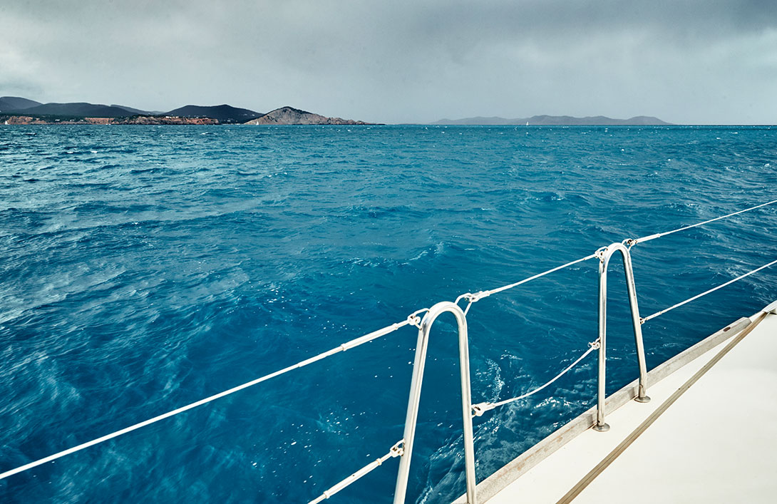
Adjust your speed and the angle to the waves according to the sea conditions, and remember that sailing through the storm will make it shorter than travelling in the same direction. When the weather cools down, and the northern winds strengthen after the storm, it's a sign that the storm has passed. However, if after the storm, even a light wind blows from the east or southeast, and the mugginess returns, another storm can be expected, if not the same afternoon, then the next day.
Weather Radar Shows if You're on the Path of a Coming Storm
The Croatian Meteorological and Hydrological Service (DHMZ) has completed the installation of a network of meteorological radars and put them into full operational use this year. This has significantly assisted sailors, boaters, and fishermen by helping them avoid storms and prepare for them promptly. The radars are strategically located along the Adriatic coast, with installations at Goli near Labin, Debeljak near Sukošan, and Uljeni on Pelješac. This network effectively covers the entire Croatian coastline and offshore areas. This feature allows everyone to access the meteor radar image and read weather forecasts on the DHMZ website, including those for sailors and boaters. The radar image precisely shows the real-time movement of cloud systems, graphically indicating those bringing rain, strong wind, and thunderstorms. It allows users to see in advance if the bay where they are anchored or the route, they are sailing is in the impact zone. In such a case, they would have at least 45 minutes to secure and prepare their boat for the storm or to navigate to a safer location. Before the existence and operation of weather radars, meteorologists could predict whether a storm front would only impact the northern part of the Adriatic or also affect Dalmatia. However, they still needed help to see the local impact precisely. Now, weather radars make it possible to observe the movement of storm clouds, allowing for forecasts that predict which specific areas will be heavily impacted by storms and which ones will be spared. This information is crucial for boaters in specific locations. Additionally, the radar provides up-to-date information and animated visuals of the movement of cloud masses and precipitation, making it easier to predict which areas might be affected.
Boaters regularly monitored the meteor radar this summer and noticed the accurate images. When the radar showed a rain cloud approaching their location, the rain or a strong thunderstorm would begin shortly afterwards. As a result, it's recommended that everyone at sea check the meteor radar status as part of their routine, in addition to reading the news or listening to the maritime forecast. This service is completely free, making it even more accessible for boaters.
Charter Offers
Working Hours:
Mon - Fri 08:00h - 16:00h
For any questions
Kraljice Jelene 3, 23210 Biograd n/M
Croatia
VAT ID: 20598733460
ID: HR-AB-23-060130534, MB: 0650676


